The Access Initiative

Q&A with Alda Salomao: Natural Gas Project Threatens Community Land in Mozambique

By Celine Salcedo-La Viña (Posted: March 5, 2015) 

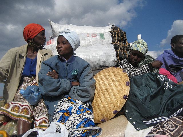
As the United States and other western countries shift from aid-based engagement in Africa to more trade and investment, it’s important to ensure that investments are environmentally and socially responsible. Investments in agriculture, infrastructure and energy can adversely affect people and the planet if the needs of local communities are ignored. Rural Africans frequently suffer displacement and lose access to vital natural resources as governments acquire their lands and allocate them to local and foreign investors—even in countries where laws recognize community land rights. Alda Salomao is the director general of Centro Terra Viva (CTV), a local NGO working to secure community land rights in Mozambique. While Mozambique has strong community land laws on the books, the provincial and district governments often fail to enforce these laws—especially as natural gas extraction expands. Here, Salomao describes the tension between communities living in the Afungi Peninsula and a natural gas project.

1) Can you give a brief background of the natural gas project in the Afungi Peninsula? About 190 trillion cubic feet of natural gas were found in the Rovuma Basin in northern Mozambique, one of the world’s most significant gas discoveries in the last 20 years. An American and an Italian company, Anadarko and ENI, independently hold offshore concession blocks in Rovuma and have agreed to jointly develop their gas discoveries under the Mozambique Liquefied Natural Gas Project. The companies began the onshore LNG plant development in 2010, selecting the Afungi peninsula as the project site.

2) How did the companies acquire the land? The government issued the companies a land-use right, known as a DUAT (Direito de Uso e Aproveitamento da Terra), for 7,000 hectares in the village of Quitupo and parts of the neighboring villages of Senga, Maganja and Patacua. Officials granted the DUAT to Anadarko and the state-owned National Hydrocarbons Company through a holding company formed by both, with ENI subsequently buying into this company and becoming a co-title holder.

3) Was this land acquisition compliant with Mozambique’s land and other laws? The process of granting the DUAT to the companies was not transparent and ran counter to national land laws. To begin with, the companies involved did not release specifics about their building plan until after they received their DUAT. The 1997 Land Law and 1998 Land Law Regulations, however, require that companies release an exploitation plan before applying for a DUAT for economic activities. More importantly, under the Land Law, local communities hold land-use rights to customarily occupied and held lands, whether or not these lands are formally registered or titled. As rights holders, they are entitled to be consulted and must give their consent on DUAT applications for their lands. CTV found that provincial authorities produced as proof of consent the minutes of a community consultation meeting held in Quitupo, bearing the signatures of community representatives. Some of the representatives deny signing any minutes. It was impossible for some to have signed as they are illiterate, while others on the list deny being present at the meeting. The communities should have also received compensation before the transfer of their land to gas companies as provided in the Land Law.

4) How have the local communities been affected so far? Perhaps the most problematic effect is the psychological, emotional and social turmoil caused by the imminent uprooting and resettlement of the entire community of Quitupo to make way for the project. Villagers in Quitupo, Senga, Maganja and Patacua were caught by surprise when company trucks began bulldozing their fields, crops and trees to make way for roads, landing fields and buildings. Company representatives gave money to villagers as compensation, although it was unclear to them how their land was acquired and how compensation was calculated. And finally, project operations began before mandatory environmental impact assessments (EIAs) and community consultations were completed. These four communities are the most affected, but the whole Afungi peninsula will likely be impacted by the project. The planned industrial city is to occupy 18,000 hectares, overlapping the lands of seven additional communities.

5) How have CTV and other NGOs responded to the natural gas project? CTV closely followed the licensing process for this project, after witnessing irregularities in the 2007 Moatize coal mining project in the central province of Tete, which caused social disturbances and violence in 2010. In an effort to avoid a similar occurrence in Afungi, CTV helped prepare local communities through legal trainings and ensuring access to project information. CTV pushed for community consultations in the EIA process, which was initiated in July 2013, seven months after the DUAT was issued. We mobilized the civil society coalition which is monitoring extractive industries and we launched a media campaign. CTV has also started a legal process to null the DUAT and ensure that future licenses are awarded in accordance with law. The government has charged CTV with promoting disobedience among the villagers. On August 20, 2013, at 6:00 a.m., three armed policemen knocked on my door and escorted me to the police station. They told me that a government official ordered my arrest, complaining that my work and that of CTV were agitating and inciting communities to violence. Officers also said the government was having difficulty communicating with Quitupo village since CTV disseminated information on land and environmental laws. 7) Are there similar cases like this reported in other areas of Mozambique? Unfortunately, there are other cases around the country involving large-scale land acquisitions by investors who fail to respect community rights and laws. The Moatize coal mining project is one example. These incidents demonstrate that beyond laws, we need to address government and corporate ethics.

8) Why is it important for Mozambique and other countries in Africa to provide communities with strong land rights? In Mozambique, the majority of the population lives in rural areas, and land will, for many years to come, be their basis for subsistence and wellbeing. Secure access and rights to land by local communities is a matter of social and economic stability and justice. The government has also proclaimed that agriculture, especially family farming, will remain the most important base for food production and rural development. Rural families must therefore be able to access and use land in a secure environment. The government must do more to prepare its citizens for the challenges resulting from increasing investments in rural lands. They have the responsibility to educate communities on their legal rights, disseminate information on development issues and impacts and include rural communities as actors in the national development process. When the government makes decisions that will have adverse social, environmental and economic impacts on citizens, it must clearly demonstrate how the benefits outweigh these costs. Displacing people from their lands without clear justification and without due process is simply unacceptable. LEARN MORE: Check out our interactive Rights to Resources map, which presents information on citizen and community rights to natural resources in sub-Saharan Africa.
Can Hi-Tech Mapping Technology Protect Traditional Land?

Article by Celine Lim, Yale F&ES ’15, originally posted on the Environmental Performance Index blog

An indigenous leader walks around the land, stopping at sites used for hunting, collecting nuts, and worship. The points are recorded using a handheld GPS device and then transferred to a computer. These points are overlaid with other land uses in the territory, and a map is produced. The map shows where oil-drilling sites are located on the same place as the community’s ancient burial ground, and where pollution from the oil operations runs through their main water source. The community now has evidence to make a case against the company. This scene was a novelty just a few years ago, but today, it is a reality for many communities around the world.

Can technology and the way it lets us understand the world help indigenous and traditional communities safeguard their resource rights? Or is it yet another imposition of modern progress on a vulnerable population? Those were the questions that brought together experts from the TAI network working in Malaysia, Guyana, and the Democratic Republic of Congo (DRC) at the TAI Fifth Global Gathering recently held in Bogotá. They were there to share just how they are testing the proposition that by using technology, those communities might be better able to map their land, its features, and monitor how they — or outside groups — use it. Such community or participatory mapping can indeed play a role in rights protection.

Community-based mapping and monitoring fulfill important purposes, especially when communities have control over data collection, management, and reporting. Many forest-dependent communities face incursions on their land from illegal logging, land grabs, and mining, but they often lack the tools needed to assert their rights to resources. With sufficient capacity and the right tools, communities can produce maps to document and prove their claims to resources. For example, if equipped with GPSes and the know-how to use one, they can record threats and the ensuing degradation through gathering live, place-specific evidence, and communicate these with their government, the mining companies, and a global audience.

Read the full story here: http://epi.yale.edu/the-metric/can-hi-tech-mapping-technology-protect-traditional-land

New Tool Reveals How Jamaica’s Development Projects Impact People and Planet

By Carole Excell and Stephanie Ratte (Posted: November 20, 2014)

Portland Bight (PBPA) is Jamaica’s largest protected area, extending more than 200 square miles of land and 524 miles of sea. The region is home to 30,000 acres of mangroves, four dry limestone forests, and several threatened species, including the critically endangered Jamaica Iguana. But last year, the Jamaican government revealed plans to lease Goat Islands, two cays located in the protected area, to China Harbour Engineering Company (CHEC) to develop a sprawling $1.5 billion trans-shipment port. The project is expected to flatten the Goat Islands and dredge sizable areas, impacting fishing, tourism, biodiversity, and coastal resilience. What’s also troubling is that the government has released scant information about the project, preventing citizens from learning about how the port may impact them or voicing their concerns at an early stage of development.

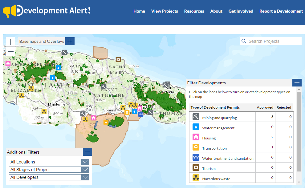
This is not an isolated incident: Like many governments, Jamaica does not proactively disclose applications at an early stage for development projects like shipping ports, highways, housing developments, and more. What information is released—such as environmental impact assessments—is presented in a format that’s difficult for citizens to access and understand. Enter Development Alert!: The new tool from WRI’s Access Initiative and the Jamaica Environment Trust aims to promote transparency and public involvement around development projects that affect the environment and public health—projects like those planned in Goat Islands. Development Alert! proactively collects and consolidates information from different government agencies on applications for new development projects, obtaining this information through requests made using the country’s Access to Information Act. The free, mobile-friendly website plots recently approved or proposed large-scale development projects on an interactive map and acts as a hub for data and information about these projects. The map includes overlays of the boundaries of protected areas, fisheries, forest reserves, and land cover so users can easily see which projects are located in environmentally sensitive areas. Types of development projects featured include mining and quarrying; water management, treatment, and sanitation; housing developments; transportation systems and highways; tourism projects like hotel construction; hazardous waste; and more. Through the site, users can:

  • View proposed and approved projects and learn about the potential impact of developments happening in their area
  • Report a development they’ve seen in their neighborhood to help increase awareness about new projects, and
  • Get involved by commenting on a development and voicing their concerns. The website allows users to email public authorities directly and provides details about scheduled public hearings.

A Clearer Picture of Development in Jamaica

In Jamaica, Development Alert! currently identifies 32 projects that are likely to have significant health, environmental, social, or cultural impacts, including four projects classified as high impact. Of these, 11 are located in or around protected areas. Development Alert! shows, for example, that the trans-shipment port in Goat Islands is not only within the Portland Bight Protected Area, but is also located within a fishery—the Galleon Harbour Nursery—and the Great Goat Island forest reserve. The fishery acts as a critical habitat for rebuilding fish populations and safeguarding marine resources, while the forest reserve protects the biodiversity found within these natural and nationally important ecosystems. Users can click on the project to see that CHEC submitted an application on January 1, 2014 to conduct a geotechnical survey, and that the government has already approved this survey through the grant of a beach license. The license allows the company to investigate the suitability of the area, including the bearing capacity of the soil and rock, by conducting a survey of the “foreshore and floor of the sea at Galleon Harbour.” As the map shows, this area is protected as a Special Fisheries Conservation Area. The survey is done through the drilling of 27 boreholes on and offshore. By signing up for alerts, posting comments, or emailing the government agency listed, anyone can voice their concerns about the Goat Islands project.

Shedding Light on Development and Empowering Communities

Development Alert! aims to bring an unprecedented level of transparency and participation to energy, transportation, mining, and other types of development projects in Jamaica. It will help shed light on potentially harmful projects, and provides resources to ensure the public can understand their rights to participate in decisions about their country’s development. Strengthening the involvement of those most affected by development decisions can lead to better, more inclusive decision-making. Over the coming months, the Access Initiative hopes to launch similar platforms in other countries. Visit developmentalert.org to explore the tool and learn more.

COMUNICADO: Latinoamérica y el Caribe iniciaran en el 2015 la negociación de un convenio regional sobre los derechos de acceso

By Daniel Barragan (Posted: November 19, 2014)

El inicio de esta negociación es una buena noticia para la región ya que significa que en el mediano plazo los países de América Latina y el Caribe (ALC) contarán con un instrumento para garantizar un ejercicio efectivo de los derechos de acceso y para una mejor canalización y resolución de los crecientes conflictos socio-ambientales, con el consiguiente mejoramiento de la gobernabilidad democrática.

Con el compromiso asumido el pasado 6 de noviembre en Santiago de Chile por parte de los Gobiernos de Latinoamérica y el Caribe, y que da vida a un comité de negociación de un instrumento jurídico internacional, la ciudadanía de la región está cada vez más cerca de contar con una herramienta de carácter internacional que garantice la aplicación efectiva de los derechos de acceso a la información, participación y justicia en asuntos ambientales. Los llamados derechos de acceso, esenciales para la protección de nuestros recursos naturales, la garantía de los derechos de las comunidades y el desarrollo sostenible de nuestros países.

Representantes de 19 países de América Latina y el Caribe firmantes de la Declaración del Principio 10 -que promueve los derechos de acceso a la información, participación y justicia en asuntos ambientales-, junto con representantes de los países observadores y actores de la sociedad civil, se congregaron en la Cuarta Reunión de los Puntos Focales designados por los gobiernos de los países signatarios de la Declaración sobre la aplicación del Principio 10 de la Declaración de Río sobre el Medio Ambiente y el Desarrollo en América Latina y el Caribe realizada del 4 al 6 de noviembre en la sede de la CEPAL en Santiago, Chile. Como resultado de esta reunión se aprobó la Decisión de Santiago, en la cual se incluyeron puntos fundamentales para la continuación de la negociación regional, entre ellos la adopción de los contenidos de San José (provenientes de la anterior reunión de grupos de Trabajo en Costa Rica), como índice de temas para la negociación del instrumento, la creación de un comité de negociación en el que se reafirma la importancia de la participación del público, y la inclusión de nuevos países en la Mesa Directiva encargada de dirigir el proceso.

Photo Essay: A Global Gathering for Environmental Rights

Article by Alisa Zomer, Yale F&ES ’14 (Posted: November 10, 2014)

The murals and graffiti that define public space in Bogota give an impression of the country’s creativity, diversity, and struggle. Emerging from a period of political and social unrest, Colombia is enjoying a period of economic growth and positive international attention. As an example of what is possible, Colombia is the perfect place for civil society to gather from around the world to learn from one another, share strategies, and get energized to move on important environmental rights. This year’s gathering, hosted by Colombian Asociacion ambiente y sociedad, had 95 representatives from over 40 countries. It focused on the intersection between technology and forest management. A defining moment of diversity and group-think was during the exercise “Agree, Disagree, Unsure.” Participants came up with controversial statements (i.e. ‘using technology is necessary for environmental protection,’ ‘democracy does not work for the environment,’ ‘business must be part of the solution,’ ‘there is no sustainable mining,’) and were asked to take a position and discuss. It was valuable to see the wide range of positions on seemingly simple issues and especially interesting experiencing participants persuade others to join their side – all with appreciation and respect.

View the full story here: http://epi.yale.edu/the-metric/photo-essay-global-gathering-environmental-rights

Gobernanza ambiental: una evaluación del Principio 10 en el Ecuador

Published: 2013

En el plano ambiental, la información y el derecho de acceso a la misma adquieren relevancia no sólo porque esta permite a la población tomar decisiones cotidianas, contribuir a la protección del medio ambiente y fomentar la mejora de las actuaciones ambientales de la industria.

También porque las decisiones del gobierno y de actores privados necesitan fundamentarse en el conocimiento actualizado del estado de los elementos del ambiente y sus implicaciones en los ecosistemas, en la salud humana y en las condiciones de vida de la población.

A raíz de la aprobación de la Constitución del 2008 se estableció un nuevo marco que refuerza y garantiza el cumplimiento de los derechos de acceso a la información, participación ciudadana y justicia ambiental. En este contexto, el CEDA consideró importante realizar un nuevo esfuerzo de investigación que permita obtener evidencia actual sobre el estado de implementación y ejercicio de los derechos de acceso.

Esta investigación busca generar evidencia concreta que permita desarrollar recomendaciones posteriores, acciones y propuestas puntuales que aporten a la retroalimentación de la política nacional y ambiental vigente y en los esfuerzos de creación de capacidades impulsados por el gobierno.

Democracia Ambiental y Desarrollo Sostenible: Hacia un Instrumento Regional sobre Derechos de Acceso

Published: 2014
Hacia un Instrumento Regional sobre Derechos de Acceso

En la Conferencia de las Naciones Unidas sobre Desarrollo Sostenible celebrada en junio de 2012, conocida como Río+20, se inició un proceso tendiente a lograr la firma de un instrumento regional en América Latina y el Caribe sobre los derechos de acceso a la información, participación pública y justicia en materia ambiental. Estos derechos se encuentran recogidos en el Principio 10 de la Declaración de Río sobre Desarrollo y Medio Ambiente, y por lo mismo constituyen los elementos fundacionales del desarrollo sostenible. 17 países de la región, representando a más de 500 millones de personas, se encuentran participando del proceso denominado “hacia un instrumento regional para la cabal implementación de los derechos de acceso”. ¿Cómo se origina esta iniciativa? ¿Cuál es la relación entre los derechos de acceso, el desarrollo sostenible y la democracia ambiental? ¿Cuáles han sido los hitos del proceso hasta ahora? ¿Qué se espera en el 2014 y a futuro? Este artículo aborda estas preguntas y analiza el potencial impacto de un instrumento jurídicamente vinculante sobre los derechos de acceso para la democracia ambiental en la región.

Indicadores de gestión ambiental: Una de cal, varias de arena


Published: 2014

Indicadores de gestión ambiental: Una de cal, varias de arena


Por tercer año consecutivo, FARN analizó los avances y retrocesos en el cumplimiento de la normativa ambiental por parte de cinco autoridades con competencia en la materia, mediante un sistema de indicadores especialmente diseñado. Esta tarea fue llevada a cabo a través del uso de pedidos de Acceso a la Información Pública Ambiental, con el fin de determinar: 1) el grado de cumplimiento de la legislación en materia de acceso a la información pública ambiental 2) el nivel de observancia de otras normas y obligaciones ambientales En esta edición, se pudo verificar un retroceso en aspectos de cumplimiento de acceso a la información; y un cumplimiento desparejo en relación a otras normas ambientales, que importan avances y estancamientos en relación con los mismos. Entre los avances se puede destacar la confección del Primer Informe Nacional sobre el Estado del Ambiente (2012) efectuado por la Secretaría de Ambiente y Desarrollo Sustentable a diez años de sancionada la Ley N° 25675 que así lo ordenaba. Entre los pendientes podemos señalar temas que hacen a la gestión de los residuos en el área metropolitana y las dificultades de implementación y control en materia de bosques y glaciares, que con el correr del tiempo se empiezan a concebir como serios estancamientos.

Jakarta Declaration for Strengthening the Right to Environmental Information for People and the Environment

Published: 2014

STRIPE Regional Meeting 2013 Presentations Day 6

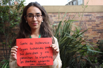
Representatives of governments, international organizations, civil society organizations, and academia from China, Indonesia, Japan, Mongolia, Philippines, and Thailand, gathered in Jakarta, Indonesia between April 29-May 1, 2013 for the Strengthening the Right to Information for People and the Environmental (STRIPE) regional meeting to propose strategies and new actions to improve environmental information in Asia for people and the environment.